
8th/9th Jan.: Storm Goretti
 (This is partly based on a post on the NCI Calshot Blog)
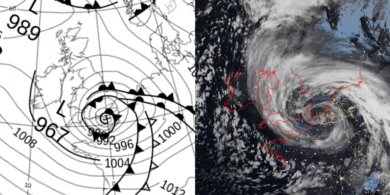
Over the night of 8th/9th January storm “Goretti” was accompanied by Met Office “red” warnings of dangerously strong winds for the west country and a gale warning for sea area Wight for “severe gale 9 to violent storm 11”. In the event wind in Southampton and the Solent did not reach those strengths. Bramble Met Post recorded winds up to force 6 or 7 but not higher, presumably because the depression centre more or less passed overhead. Indeed the rough seas generated by the storm resulted in containers being washed overboard from vessels near the Nab Tower and south of St Catherines Point.
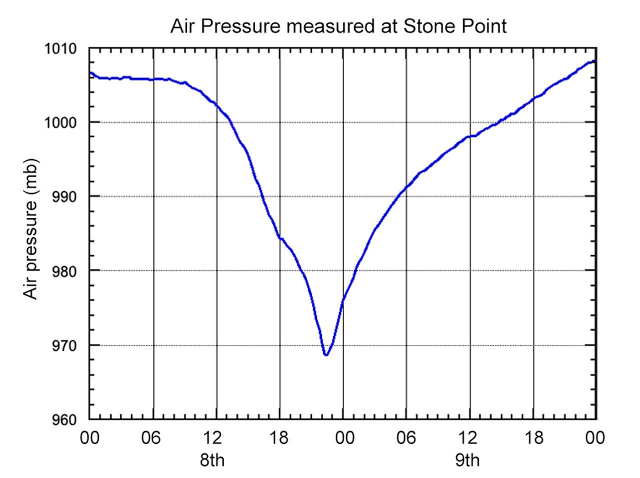 The rate of pressure variation was remarkable. In one hour, between 21hrs and 22hrs, the pressure fell by over 6mb. Then in the one hour between 23hrs and midnight it increased by a similar amount.
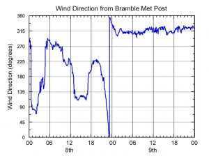
As might be expected the storm passage was marked by changes in wind direction and speed. However there was a difference in the wind speeds recorded at Bramble and Stone Point.
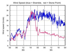
The graph of wind speed at both Stone Point (red) and Bramble Met Post (blue) shows that the apparent decrease of wind shown on the Stone Point website after 22hrs on the 8th did not occur at Bramble Met Post. Whereas Bramble Met Post continued to record force 6 to 7 wind speeds, at Stone Point the recorded wind speed was only force 3!
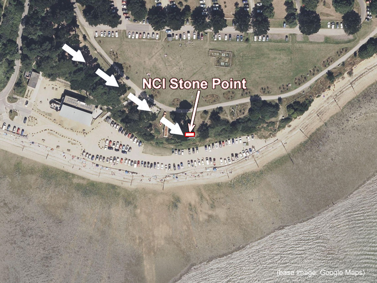 After around 22hrs the wind was about 310 degrees (shown by the arrows on the aerial view). The line of trees along the edge of the cliff top would have been directly upwind of the anemometer on the southwest corner of the NCI Stone Point station. So the anemometer at Stone Point was sheltered from the full force of the wind by the trees in Lepe Country Park.
Since Storm Goretti I have had to revise the polar diagram of wind speed “corrections” to take this potential error into account. It turns out that when I did the original analysis there were few, if any, strong winds from this direction.
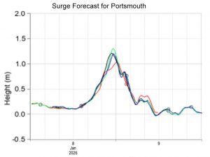
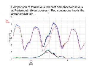
Storm Goretti resulted in a storm surge of about 1m. Fortunately the peak surge was before the time of astronomical high tide so the total tide did not cause floods in St Denys. It was well forecast by NTSLF.
Acknowledgement: the satellite photo was from the Met Office Blog.